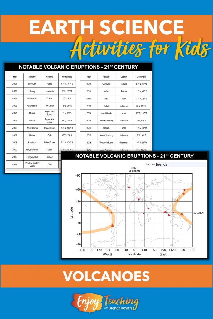
Mapping volcanoes is a great way to teach kids about fast changes to Earth’s surface. First, help your students understand latitude and longitude. Second, ask them to plot the coordinates of 27 notable volcanoes of the 21st century. Voila! Authentic plate tectonics diagrams!

Posts on this website follow a teaching journey and are written in story form.
Ms. Sneed Teaches Kids About Fast Changes to Earth’s Surface
Our favorite fourth grade teacher, Ms. Sneed, pointed to the fast and slow changes posters on her classroom wall. “Now that our kids have finished the slow changes experiments,” she said to her co-teacher, “they understand weathering, erosion, and deposition.”
Mr. Frank looked up at the posters. “Yep,” he replied, “now they’re ready for fast changes: volcanoes, earthquakes, landslides, and tsunamis.”
Ms. Sneed opened her laptop and began to search for earth science activities.
“Aha!” she exclaimed. “Volcano mapping activities.” She swiveled her computer to show her teaching partner, Mr. Frank.
Mapping Volcanoes of the 21st Century
“Cool! After we teach our kids about latitude and longitude, they’ll get busy mapping volcanoes. What a great way to integrate social studies and science.”
“Furthermore,” Ms. Sneed responded, “once they’ve plotted the coordinates, they should be able to locate the Ring of Fire.”
“Actually,” her co-teacher responded, “this addresses one of our science standards.” He pulled them up on his laptop and read aloud:
NGSS 4-ESS2-2 Analyze and interpret data from maps to describe patterns in Earth’s features.
Activities to Supplement Mapping Volcanoes
Next, Ms. Sneed scrolled down farther in the resource. “With these cards, kids can do more interdisciplinary activities. Each child works with one volcano.” Both teachers looked over the page and studied the possibilities.
“First,” Ms. Sneed continued, “they divide the height of the volcano by 1000. Then they measure a piece of yarn to equal that distance.”
“Kids can sort and compare the heights. And hey, we can create a display in the hall!” Mr. Frank exclaimed.
“Additionally, they can also average the heights, determine which continent has the tallest volcanoes, and more.”
“This set of volcano activities provides lots of standards-based activities,” Mr. Frank said.
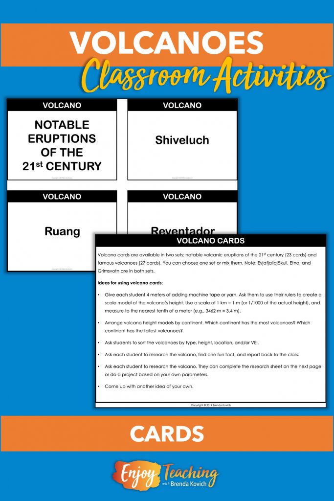
Volcano Research
“And here’s more,” said Ms. Sneed. “Research. I love this short geosphere project.”
The two teachers looked at each other and smiled. “This mapping volcanoes set is perfect,” Ms. Sneed said.

Enjoy Teaching Volcano Mapping
For more than 30 years, I enjoyed teaching upper elementary students – mostly fourth grade. Now I tell my tales through a fictitious educator, Ms. Sneed. Like you, she grapples with day-to-day classroom challenges. And like you, she meets those challenges head-on. Hopefully, her story of mapping volcanoes will give you ideas and inspiration to use for your own plate tectonics project. ~ Brenda Kovich


